
I had a trip around the Skares and Netherton Coal Sites this morning as a member of the technical working group that helps guide the restoration.
With nearly 14mm of rainfall in Mauchline in the last 24 hours and probably more at these nearby sites, I was interested to see how they were coping with surface water run off and water management. Encouragingly, there didn’t appear to be an issues with polluted water leaving the sites. It’s changed days since ATH (the former owner and operator that went bust) ran these sites when pollution of the burns and the Lugar wasn’t uncommon. Thank goodness lessons have been learned and there’s better management in place now.
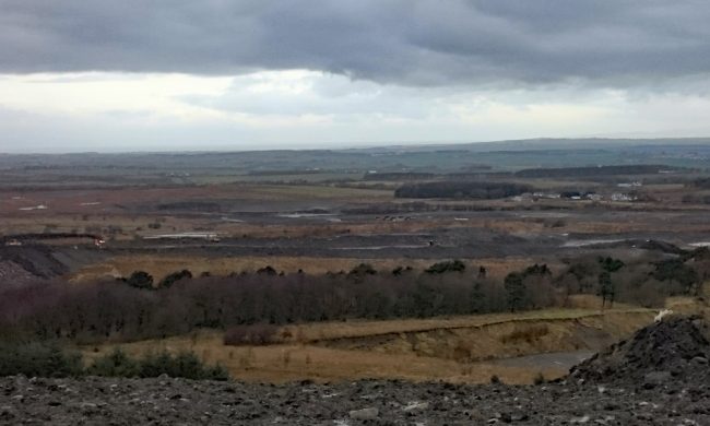
The view westwards from the Netherton tip towards Ochiltree and the river Ayr valley. There’s still restoration to be completed across this area in the fore to mid ground.
The restoration process is well underway and Netherton site is nearing completion. Once the weather dries up, the soiling will continue and then seeding will take place. Finding adequate soil and peat to cover the site is challenging but I hear excess peat from the Scottish Power Energy Network contract nearby will be brought in. Barr Ltd are supplying green wasted composted products from their Garlaff site and other waste soils may be available.
Restoration of the Skares site is also progressing and work to fill the void behind Skares village is well underway. The material to fill the void is coming from the tip that can be seen from the road. This will reduce the height of the tip which will be regraded to blend in with the new contours. Once filled, there will be no surface water left in the void and the Watson and Ward Burns will be restored back to something like their original course (as far as possible).
The Skares void is being filled to leave no standing water. The residents of the village were concerned about the dangers of a large sheer sided water body so close to their village and East Ayrshire council have agreed to fill the void completely in respect of these concerns.
There are sections of the undisturbed Ward burn still within the site and these will be reconnected with a new channel filling the gaps. I noticed two former electrofishing sites that Brian Shaw and I surveyed prior to mining taking place, way back around 2008. I’ve suggested these should be resurveyed to see what if anything survives and to inform any mitigation measures that may be required.
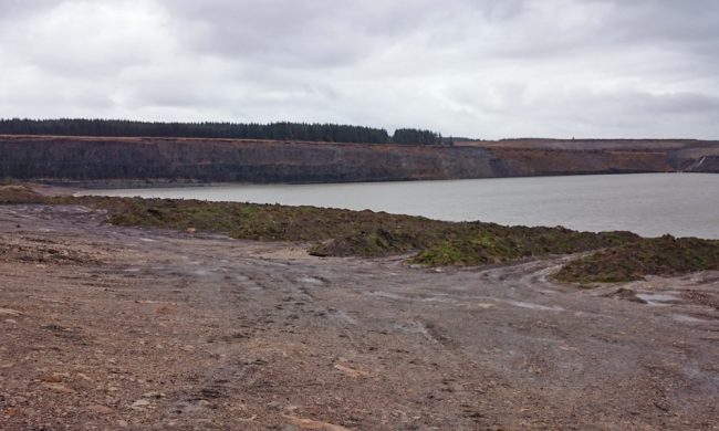
There will be several large water bodies left on site, some more beneficial to wildlife than others but efforts are being made to ensure there are shallow margins where possible. Perhaps in time once the sites are restored and naturalise and paths created to allow access for the public, some of these waterbodies may be useful as fisheries and I mentioned this during the tour. Time will tell. At least those with shall margins may be of benefit to wading birds and overwintering. Broad-leaved tree planting and probably plantation forestry will feature once the earthworks are completed. The Scottish Government are keen to use ‘brownfield sites’ to meet their timber targets.
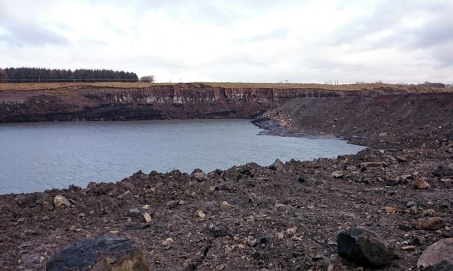
A large void with no inlet or outlet….effectively a stank. Excess water from this void seeps through the backfilled overburden and collects in another void lower down the hill (see the next image). By the end of the restoration process, this ‘loch’ will have shallow margins and gently sloping shores on all but the far side of the area. This may mean offer some potential as a fishery and wildlife area, particularly for birds.
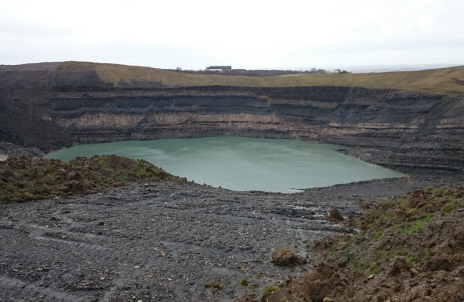
Not all voids are equal and this one will unfortunately not be filled as there isn’t enough material available on site (or at least adequate finances available to backfill it). The depth of the water once the void fills to the expected levels will be somewhere about 80 – 90m deep. The water margins are sheer making this unsuitable for wading birds and also of little value for fish and fishing.
In the meantime, work continues.
Source: Ayshire River Trust – Restoration of Netherton and Skares Coal Sites